Category:Ancoats and Beswick
Jump to navigation
Jump to search
English: Manchester City Council ward
electoral ward of Manchester City Council _2018.png) | |||||
| Upload media | |||||
| Instance of |
| ||||
|---|---|---|---|---|---|
| Named after | |||||
| Location | Manchester, Greater Manchester, North West England, England | ||||
| Inception |
| ||||
| Replaces |
| ||||
 | |||||
Subcategories
This category has the following 4 subcategories, out of 4 total.
A
B
N
Media in category "Ancoats and Beswick"
The following 30 files are in this category, out of 30 total.
-
 Broadside - geograph.org.uk - 6306662.jpg 5,999 × 3,534; 1.86 MB
-
 Central Retail Park - geograph.org.uk - 6126344.jpg 6,000 × 3,152; 1.73 MB
-
 Chips and the Ashton Canal - geograph.org.uk - 5877064.jpg 640 × 480; 293 KB
-
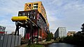 Chips Building by Ashton Canal, Ancoats, Manchester - geograph.org.uk - 6338319.jpg 5,184 × 2,920; 4.72 MB
-
 Cobbled bridge at New Islington Wharf - geograph.org.uk - 6006905.jpg 1,200 × 1,600; 544 KB
-

-
 Darby and Joan - geograph.org.uk - 5877645.jpg 640 × 480; 322 KB
-
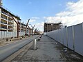
 Demolition site. Poland Street, Manchester - geograph.org.uk - 5824859.jpg 3,531 × 2,326; 3.55 MB
-
 Disused buildings along the Ashton Canal - geograph.org.uk - 5834437.jpg 3,264 × 1,836; 1.1 MB
-
 Disused gasometers at Bradford Road - geograph.org.uk - 5957966.jpg 1,024 × 571; 236 KB
-
 Entrance to Royal Mills - geograph.org.uk - 5877022.jpg 640 × 480; 310 KB
-
 Gone fishing - geograph.org.uk - 5822130.jpg 1,280 × 960; 811 KB
-
 Hallé St Peter’s - geograph.org.uk - 5869204.jpg 600 × 800; 587 KB
-

-

-
 Looking Upstream on The Medlock - geograph.org.uk - 6253028.jpg 678 × 1,024; 287 KB
-
 Medlock River - geograph.org.uk - 6253043.jpg 678 × 1,024; 242 KB
-
 Medlock Valley Way Cycle Path - geograph.org.uk - 6253036.jpg 1,024 × 678; 234 KB
-
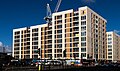
 More apartments rising up - geograph.org.uk - 5821685.jpg 1,280 × 993; 981 KB
-
 Mount Pleasant House - geograph.org.uk - 5892163.jpg 6,000 × 4,000; 1.68 MB
-
 Narrowboats on the New Islington Marina - geograph.org.uk - 5877057.jpg 640 × 480; 279 KB
-
 Old Mill Street - geograph.org.uk - 5821692.jpg 1,280 × 960; 774 KB
-
 Pedestrian Walkway over Ashton New Road - geograph.org.uk - 5998700.jpg 1,280 × 864; 704 KB
-
 Retirement homes in George Leigh Street - geograph.org.uk - 5877647.jpg 640 × 480; 320 KB
-
 River Medlock - geograph.org.uk - 6253019.jpg 678 × 1,024; 251 KB
-
 Spear Street - geograph.org.uk - 6306663.jpg 3,732 × 4,030; 1.9 MB
-
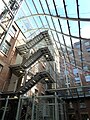 The atrium, Royal Mills - geograph.org.uk - 5877026.jpg 480 × 640; 327 KB
-
 Towerblock at Islington Wharf - geograph.org.uk - 5957956.jpg 1,012 × 1,024; 341 KB
-
 Urban Regeneration - geograph.org.uk - 5821762.jpg 1,280 × 983; 902 KB
-
 Weaver's Quay - geograph.org.uk - 6306667.jpg 3,940 × 5,910; 1.71 MB


